New River Trail State Park at Foster Falls
176 Orphanage Dr. Foster Falls, VA 24360
Telephone (276) 699-2460 or (276) 699-1034
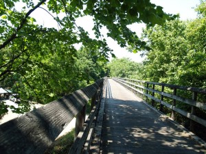
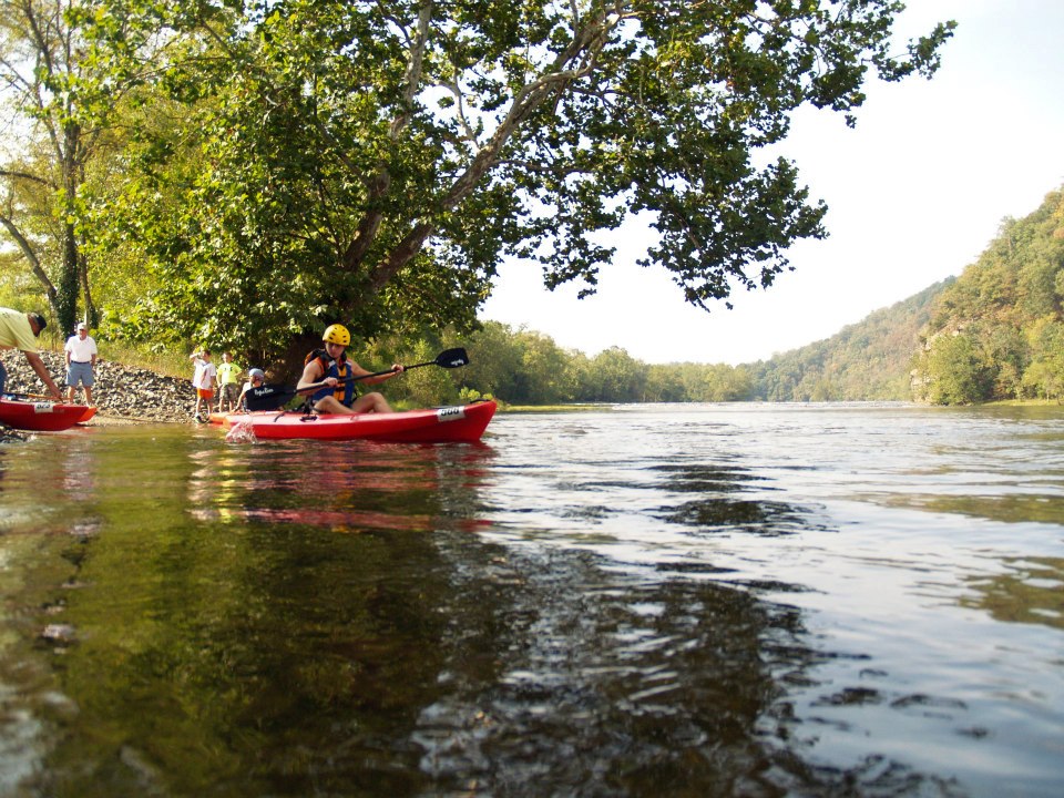
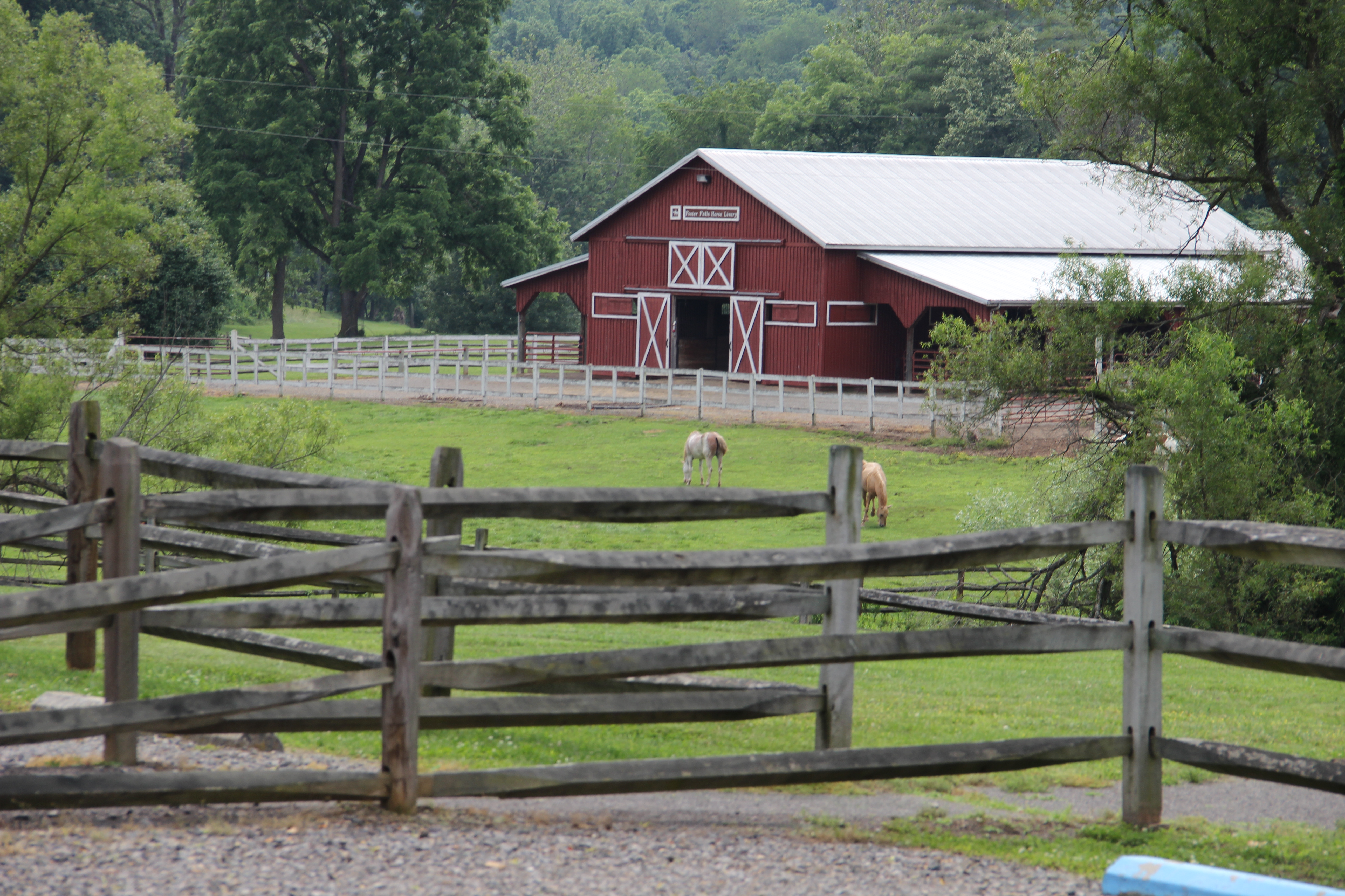
New River Trail is a 57-mile linear park that follows an abandoned railroad right-of-way. The park parallels the scenic and historic New River for 39 miles and passes through four counties and the city of Galax. The trail’s gentle slope makes it great for visitors of all ages to hike, bike and ride horseback. The park’s Foster Falls area offers guided horseback trips; horse, canoe and bike rentals; boat launches; gift shops; and a horse arena. Fishing is popular, and primitive campsites dot the trail. The park hosts a horse arena, and guided horseback trips are available. There are access points to the trail at Allisonia, Chestnut Yard, Cliffview, Dannelly Park (near Galax), Draper, Dora Junction (near Pulaski), Foster Falls, Fries, Galax, Gambetta, Hiwassee and Ivanhoe. Horse trailer parking is available at Allisonia, Austinville, Cliffview, Dora Junction, Draper, Fries, Ivanhoe and the Foster Falls arena.
- Two tunnels: 135 feet and 193 feet long
- Three major bridges: Hiwassee – 951 feet; Ivanhoe – 670 feet; Fries Junction – 1,089 feet
- Nearly 30 smaller bridges and trestles
- A historic shot tower used more than 200 years ago to make ammunition
Hours
Dawn – dusk.
Location
There are several entrances into this park. The park meanders through Grayson, Carroll, Wythe and Pulaski counties and Galax in southwestern Virginia and parallels the scenic and historic New River for 39 miles.
Its address is 116 Orphanage Dr., Max Meadows, VA 24360.
Foster Falls: Latitude, 36.530512. Longitude, -80.512931.
Shot Tower: Latitude, 36.522000. Longitude, -80.522033.
Cliffview: Latitude, 36.408613. Longitude, -80.550665.
Jurisdictions:
Counties: Carroll, Grayson, Pulaski and Wythe
Cities: Galax
Towns: Allisonia, Austinville, Draper, Fries, Hiwassee, Ivanhoe, Pulaski
Entrances:
- Galax – Parking is available where Route 58 crosses Chestnut Creek. Parking fee required.
- Cliffview – Take Route 58 to Galax; go north on Route 887 to Cliffview Road (Route 721). The parking area is on the left, across from Cliffview Mansion. Parking fee required.
- Gambetta and Chestnut Yard – Take Route 721 north past Cliffview to Route 607. Follow Route 607 to Chestnut Yard or turn on Route 793 to go to Gambetta. Parking fee required.
- Fries – From Route 94, go south to town. Parking is available near the town park. Parking fee required.
- Byllesby Dam – Go east on Route 602 off Route 94. Park at the dam.
- Ivanhoe – Go east on Route 639 off Route 94. Parking fee required.
- Shot Tower – From I-77, take Exit 24; go east on Route 69 to Route 52 and follow signs to Shot Tower. Hikers only may access at Shot Tower. Parking fee required. Bicyclists must use road access to the trail. Horse parking is available at the Mark Hufeisen Horse Complex, which is .2 miles from Shot Tower.
- Draper – From I-81 exit 92, take Route 658 East through Draper. Parking is available across from Bryson’s Store, less than one mile from the interstate highway. Parking fee required.
- Pulaski/Xaloy/Dora Junction – From I-81 exit 94, take Route 99 West approximately two miles to Xaloy Drive; turn onto Xaloy Drive to entrance. Parking fee required.
- Foster Falls (New River Trail administrative offices) – From I-77, take Exit 24, go east on Route 69 to Route 52, go north to Route 608, go east and follow signs. Parking fee required.
- Austinville – From I-77 exit 24, go west on Route 69 for about 4 miles. A parking lot is on th eleft just before the bridge over the New River.
- Horse trailers may be parked at the Allisonia, Austinville, Cliffview, Fries, Draper, Ivanhoe, Pulaski and Mark E. Hufeisen Horse Complex (Foster Falls) entrances only.
- Allisonia and Hiwassee parking areas are off Julia Simpkins Rd., State Route 693, in the Allisonia-Hiwassee area.
- Potable water is available only at Galax, Cliffview Campground (Dannelly Park), Foster Falls, and the Ivanhoe, Draper and Dora Junction horse trailer parking lots. Bring enough drinking water for your trip.
- Five non-flush toilets are available along the trail.
Drive Times: Charlotte, N.C., 2 hours; Knoxville, Tenn., 3 hours; Winston-Salem, N.C., 1 hour.
Park Size
1,337 acres. Width averages 80 feet; length from Galax to Pulaski, 51.5 miles; Fries Branch, 5.5 miles; the total length is 57 miles.